Northern California Coast Beaches
Beaches near Turtle Rocks Oceanfront Inn
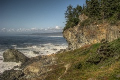
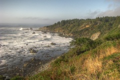
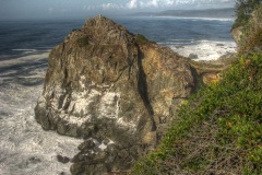
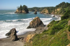
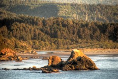
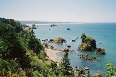
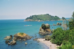
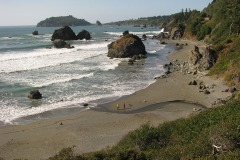
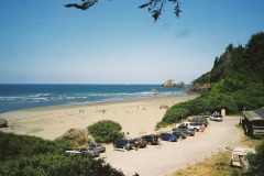
Trinidad boasts the most magnificent stretch of coastline in all of California. Its distance from the Bay Area and Los Angeles have kept it one of the state’s best kept scenic secrets. It is a natural showcase of emerald islands, ocean caves, gigantic offshore rocks, endemic wildlife, jagged headlands, and myriad unique beaches, each having a distinct character. The native Yurok Indians considered every rock and cove to be sacred, attributing names to each one, as well as stories about their origins.
The coastline spans from the giant sea stacks of Patrick’s Point State Park in the north to the mouth of Little River in the south. The Turtle Rocks Oceanfront Inn is situated on one of the most dramatically beautiful stretches of this sacred coastline. Nestled in a protective cove with a panoramic view of two giant headlands, a 180 degree expanse of sea, and an abundance of offshore rocks teaming with sea lions and other aquatic life, the Inn is also in an ideal location for accessing the other coastal attractions Trinidad has to offer.
Below is a complete list of public beaches in Trinidad, listed from north to south, with directions from the Turtle Rocks Oceanfront Inn.
Sue-Meg State Park (formerly Patrick’s Point State Park)
If you could only visit one place on your journey through Humboldt County, or even all of the Northern Californian coast, Sue-Meg State Park would be your destination. This spectacular park could be aptly named “Yosemite-by-the-sea” because it features the most stunning rock formations anywhere on the Western seaboard of the United States. The native Yurok Indians considered this place, which they called Sumeg, the holiest of holy places, thinking of it as “the abode of the last immortals”. The giant rocks, technically called “sea stacks” have literally risen out of the ocean over millions of years of geologic time. You will truly feel like you have entered a lost world, and in fact, some of the film The Lost World directed by Steven Spielberg, was filmed here. There are a number of beaches sprinkled along the “Rim Trail” which runs along the ocean around the entire park, the most visited being Agate Beach in the north part of the park. Rock hounds are often rewarded here with beautiful agates that are thrown up on the beach, especially during big surf days in the fall, winter, and spring.
Directions: You can drive or walk from the inn to Sue-Meg State Park. Take a left out of the Turtle Rocks Oceanfront Inn parking lot and head north on Patrick’s Point Drive 0.8 miles. On your left you’ll see the park entrance.
Martin Creek Trail
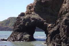
This is the most recently opened beach in Trinidad, and you will most likely have the entire place to yourself. This is a very rocky beach, so don’t expect sand, but do expect spectacular offshore rocks and headlands, including an arch offshore.
Directions: Turn right out of the Turtle Rocks Oceanfront Inn parking lot and head south a few miles on Patrick’s Point Drive taking a right on Stage Coach road. Head south another mile until you come to a hairpin curve on the road where there is a Eucalyptus grove. Park under the Eucalyptus trees and walk towards the tip of the hairpin curve. You will see a small stone with “Martin Creek Trail” written on it.
Elk Head and College Cove & College Cove Beach
Elk Head is a rugged promontory featuring views of Trinidad Head and College Cove to the south, as well as amazing views of the cliffs to the north. The end of the trail leads down to a “blowhole” where ocean waves come in under the rocks and shoot water towards the sky through small holes. College Cove is a large sandy beach between Pewetole Island and Elk Head.
Directions: Turn right out of the Turtle Rocks Oceanfront Inn parking lot heading south on Patrick’s Point Drive and take a right on Stage Coach Road. Head south for a few miles until you see an opening to a fairly large parking area on the right hand side. This is the access for both Elk Head and College Cove.
Trinidad State Beach
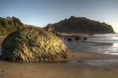
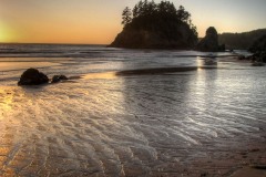
This is one of Trinidad’s iconic beaches, featuring a number of rocks, arches and islands that have been on the cover of countless postcards, in paintings, and calendars. The one drawback is that it can often be more windy than the more protected beaches south of Trinidad Head like Luffenholtz Beach, though that’s not always the case. It is a large sand beach beginning at the northern side of Trinidad Head and ending at the jaw-dropping Pewetole Island in the north. In the middle of the beach is Mill Creek, which is lined with beautiful rocks as it exits into the ocean. Just north of this is the “old man” rock, which literally looks like an old man looking out into the ocean. If you’re really lucky and it’s low tide, you can walk out to the base of the gigantic Pewetole Island, as well as see the most beautiful rock arch in all of Trinidad.
Directions: Turn right out of the Turtle Rocks Oceanfront Inn parking lot heading south on Patrick’s Point Drive until you reach the stop sign in town. Take a right on this street (main street) and follow it until it veers left turning into Trinity Street. As you head straight towards the lighthouse the road will veer right, becoming Edwards Street. Follow it as it descends down toward the ocean next to the beach. Parking is on the right-hand side.
Trinidad Head
Although not a beach, no catalog of Trinidad’s coastline would be complete without mentioning this enormous and strategic headland. Trinidad Head is the largest single geologic and geographic feature in Trinidad as well as the most defining. It is placed at the point where Trinidad Bay meets the Pacific Ocean to the west, providing a safe haven for Trinidad Harbor to exist peacefully. You can walk up the road leading to the lighthouse (the real one, unlike the one to be found in town), and from there can explore the numerous trails leading to dramatic vistas.
Directions: Turn right out of the Turtle Rocks Oceanfront Inn parking lot heading south on Patrick’s Point Drive until you reach the stop sign in town. Take a right on this street (main street) and follow it until it veers left turning into Trinity street. As you head straight towards the lighthouse the road will veer right, becoming Edwards Street. Follow it as it descends down toward the ocean where there will is a large parking area. From the parking are there is a small road that ascends upward onto Trinidad Head which you can’t drive up, but you can hike up, and from there there are plenty of trails to explore.
Pier Beach
Pier Beach doesn’t fall short on its name, it’s right next to the pier! But more amazingly, it’s overshadowed by the mammoth Trinidad head and Little Trinidad Head (which also happens to be massive). At low tide you can walk beneath the pier and there are interesting tide pools. This beach is small, but nice for a little stroll and enjoying the great setting. Don’t forget to take a walk onto the pier, and if open, walk down on to the floating platform on the bay where small fishing boats land.
Directions: Turn right out of the Turtle Rocks Oceanfront Inn parking lot heading south on Patrick’s Point Drive until you reach the stop sign in town. Take a right on this street (main street) and follow it until it veers left turning into Trinity street. As you head straight towards the lighthouse the road will veer right, becoming Edwards Street. Follow it as it descends down toward the ocean.
Old Home Beach (also known as Indian Beach) – Trinidad, California
Directly south of the plateau on which the town of Trinidad is built, the ancient village of Tsurai was once settled in the much more protected bluffside, adjacent to what is now known as Old Home Beach. Being the most sheltered as it is positioned at the heart of Trinidad Bay, Old Home Beach stretches from Little Trinidad Head southward. When you reach the end of the sandy stretch, you can walk over some rocks into the next beaches south, which aren’t accessible by any other trails.
Directions: Turn right out of the Turtle Rocks Oceanfront Inn parking lot heading south on Patrick’s Point Drive until you reach the stop sign in town. Take a right on this street (main street) and follow it until it veers left turning into Trinity Street where you will find a viewpoint where the Memorial Lighthouse was formerly located. The trailhead is here.
NOTE: As of April 2025, this trail is closed and doesn’t look like it will be open again in the near future, so there is currently no access to this beach.
Baker Beach – Trinidad, California
A designated nude beach, but don’t let that turn you off if you’re not so inclined. This is a spectacular beach, even for Trinidad, and that’s saying something! Nestled between a gorgeous rocky headland in the south and another in the north, the middle of the beach features its own offshore mini-island. The beach is sandy in the south, but awesome for rock collecting in the north, as there is always an assortment of agates, shells, and beautiful small stones waiting to be found.
Directions: Turn right out of the Turtle Rocks Oceanfront Inn parking lot and head south on Patricks Point Drive until you reach the stop sign in town. From there, head straight down Scenic Drive past the Casino until the road becomes straight. To the left you will see Baker Ranch Road, but keep heading straight 100 feet or so where there are a number of trees near the road, park there. The trail will be on your right.
Luffenholtz Beach and Tepona Point Headland
Overlooking both Houda Beach to the South and Luffenholtz Beach in the north, Tepona Point is a narrow spindle of rock sticking out into the ocean offering awesome views of Camel Rock to the south, Trinidad Head to the north, and countless offshore rocks. A quarter of a mile to the north is the entrance to Luffenholtz Beach itself, leading down to Luffenholtz creek, the largest waterway in all of Trinidad. Luffenholtz is a beautiful sandy beach, but also contains a number of beautiful offshore, as well as onshore rocks. If you keep walking north and climb over a few rocks, you’ll find a northern stretch of beach that is very rocky and often uninhabited, an amazing ‘secret’ spot.
Directions: Turn right out of the Turtle Rocks Oceanfront Inn parking lot and head south on Patrick’s Point Drive until you reach the stop sign in town. From there, head straight down Scenic Drive past the Casino, past Baker Ranch Road, and right after you pass Okega Lane scenic drive will curve right. There will be a small parking lot to the right where the trail for Luffenholtz Beach descends down a number of steps. To access Tepona Point, drive a few hundred feet further south where there is a bigger parking area on the right.
Houda Beach – Trinidad, California
This stunning beach can be broken down into three parts: the sandy stretch in the south, Houda Head, and the northern stretch. At low tide, one can walk beside beautiful cliffs towards Moonstone Beach and view a small waterfall cascading onto the sand. Houda Beach is the closest point to view Camel Rock, the single largest offshore rock on the entire Humboldt Coast. It consists of two gigantic humps, from which it derives its name. For the best view, walk to the top of Houda Head. The beach is also used as an access point for the surf break, and Houda Head is excellent for rock climbing.
Directions: Turn right out of the Turtle Rocks Oceanfront Inn parking lot heading south on Patrick’s Point Drive and take a left on Seawood Drive. Take a right on Highway 101 heading south and exit at the Clam Beach road overpass, drive over the overpass and head northward on highway 101, exiting at Westhaven Drive. Take a left heading under the overpass, then head right on scenic drive until you come to a parking area that will appear on the left side of the road. There will be wooden posts with large metal rings connecting them.
Moonstone Beach
Being the furthest south of Trinidad’s Beaches, Moonstone tends to receive the most visitors, many of whom are surfers attracted to one of the best breaks in the county. Other activities include rock climbing, as well as a large cave. The shape of the beach changes due to the caprice of Little River, which exits here into the ocean. At low tide you can walk to the next beach north, Houda Beach.
Directions: Turn right out of the Turtle Rocks Oceanfront Inn parking lot heading south on Patrick’s Point Drive and take a left on Seawood Drive. Take a right on Highway 101 heading south and exit at the Clam Beach road overpass, drive over the overpass and head northward on highway 101, exiting at Westhaven Drive. Take a left heading under the overpass, then head left on Scenic Drive. Take a right down the first substantial road and go straight until you reach the parking lot of the beach.
Clam Beach
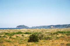
Although technically not part of Trinidad, this expansive dune beach features excellent views of Trinidad Head and the southern coastal headlands. Perfect for a picnic, jog, or casual stroll.
Directions: Turn right out of the Turtle Rocks Oceanfront Inn parking lot heading south on Patrick’s Point Drive and take a left on Seawood drive. Take a right on Highway 101 heading south and exit at the Central Avenue exit and take a right. There will be a large parking lot on the left.


